Jump to navigation
Jump to search

No higher resolution available.
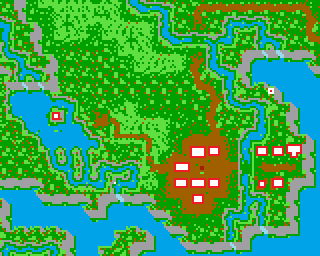
SavageEmpire_map_v05_Barako.png (320 × 256 pixels, file size: 10 KB, MIME type: image/png)
In-game map of a village. Buildings have been highlighted in red and white.
File history
Click on a date/time to view the file as it appeared at that time.
| Date/Time | Thumbnail | Dimensions | User | Comment | |
|---|---|---|---|---|---|
| current | 11:59, 18 March 2016 | | 320 × 256 (10 KB) | Abacos (talk | contribs) | Marked the Kotl teleport plate |
| 11:53, 10 March 2016 |  | 320 × 256 (10 KB) | Abacos (talk | contribs) | Marked Topuru's islet location | |
| 11:37, 10 March 2016 |  | 320 × 256 (10 KB) | Abacos (talk | contribs) | In-game map of a village. Buildings have been highlighted in red and white. Category:Worlds of Ultima: Savage Empire images Category:Maps |
You cannot overwrite this file.
File usage
The following page uses this file: